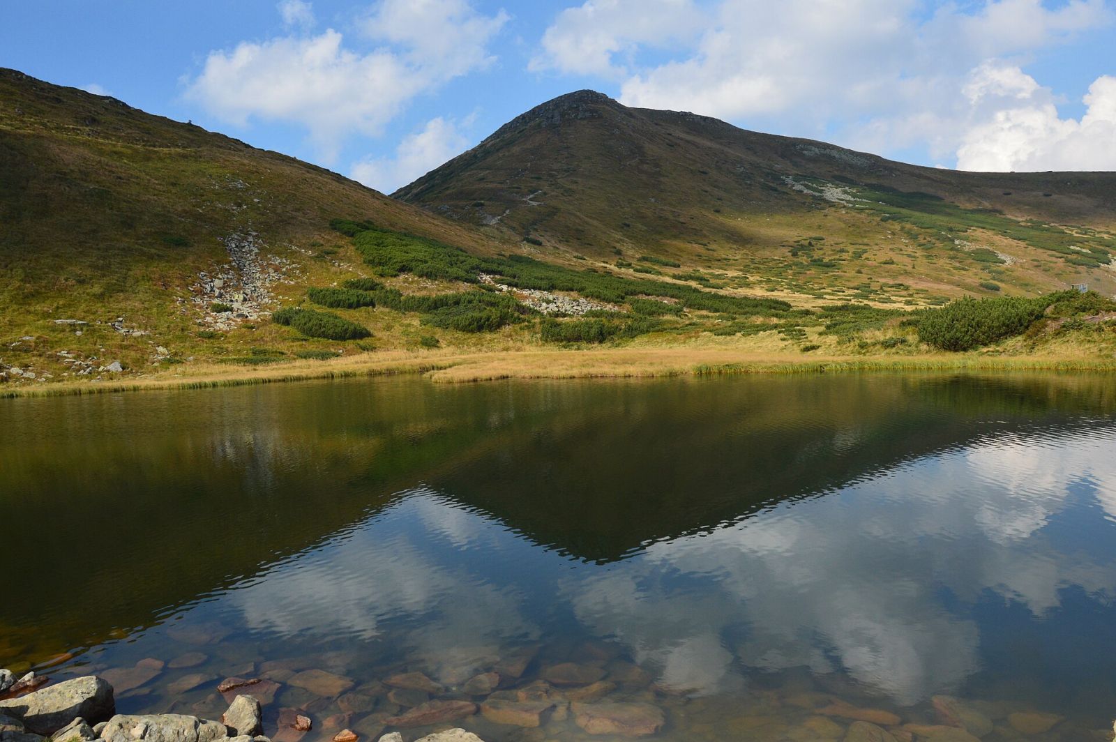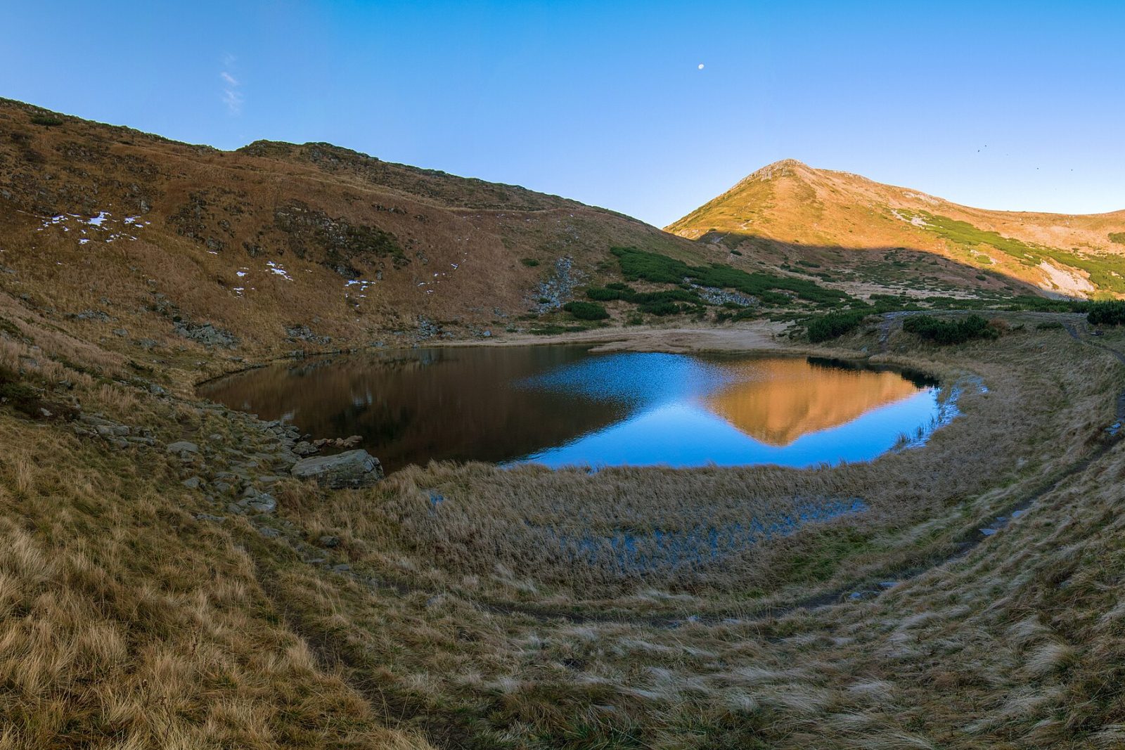


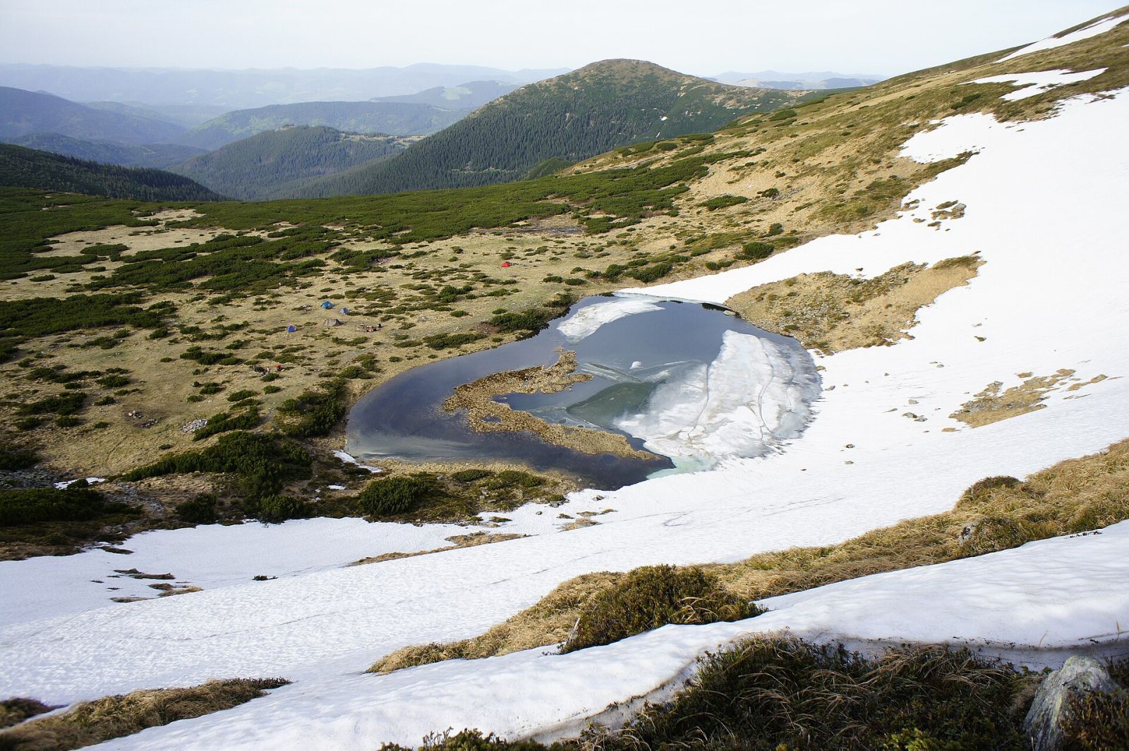
Nesamovyte Lake sits at roughly 1,750 metres on the Chornohora ridge of the Ukrainian Carpathians, tucked beneath the northern flank of Mount Turkul, and the only way in is on foot, fastest from the Zaroslyak base in about 2.5 hours of steady climbing. The water is barely knee-deep, not the bottomless pool your imagination expects: the lake is tiny, roughly 88 by 45 metres and under a metre and a half deep, and that deceptive modesty is exactly why people underestimate it. This is one of the best-known glacial lakes in Ukraine, and its fame rests on legend far more than on size.
What kind of lake is this, and what the name means
Nesamovyte is glacial in origin. Thousands of years ago a glacier gouged a cirque into the slope, and when it melted it left behind this shallow basin, fed by snowmelt and rain. There is almost no outflow, so the water stays cold even at the height of summer, rarely warmer than 10-12 degrees Celsius. You can technically swim, but few try: step in and your legs go numb within a minute.
The name tells you plenty. Nesamovyte means frenzied or untameable, and it ties to a local belief that the lake has a temper. Hutsul shepherds long treated it with caution and kept their voices down near the water.
The legend: why you must not throw stones
The one rule any guide will drum into you: do not throw stones or toss anything into the water. According to the belief, a disturbed lake answers with foul weather, conjuring a storm of thunder and rain, and whoever provokes it risks descending on slick rock in a downpour. A sceptic shrugs. But weather on Chornohora turns within half an hour without any help from stones, so the rule holds up on common sense alone: silence over the water never hurt anyone.
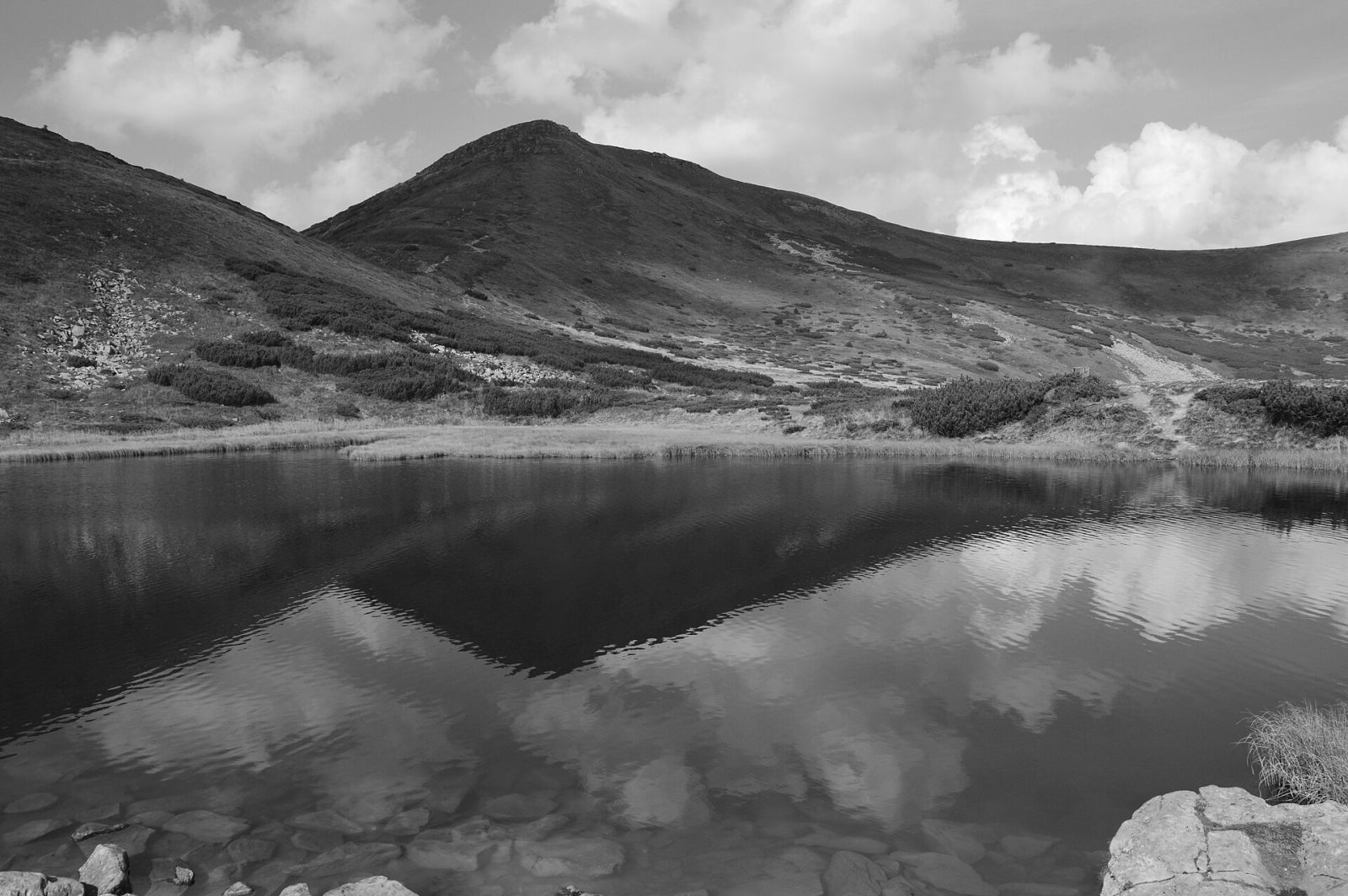
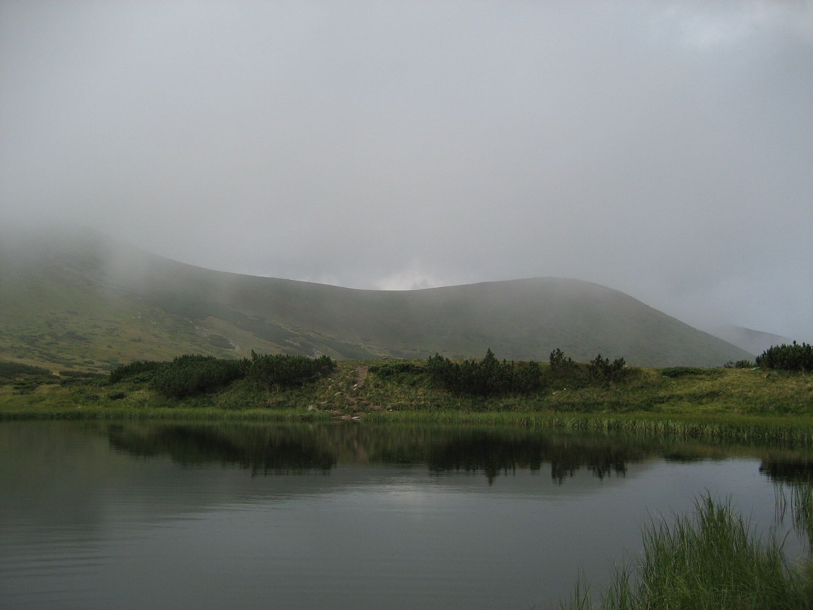
There is a darker version too, that the souls of sinners wander in the lake, which is why it is called frenzied. Folklore aside, what is genuinely true is that the place is remote, and in fog it does look eerie.
How to get there: the routes
The starting point is almost always the same: the Zaroslyak base and clearing (around 1,300 m) inside Carpathian National Nature Park. Travellers reach it by car or transfer from the Vorokhta side. From there, the route splits into a few sensible options.
| Option | What it covers | Round-trip time | Difficulty |
|---|---|---|---|
| Lake only | Zaroslyak, trail below Turkul, descent to the lake | 5-6 hours | Moderate |
| Via Hoverla | Zaroslyak, Hoverla (2,061 m), ridge to Turkul, lake | 8-10 hours | Above moderate |
| Loop: Hoverla + Turkul + lake | Full day along the ridge, back to Zaroslyak | 9-11 hours | Hard |
The simplest path runs from Zaroslyak up to the meadow below Turkul, then a short drop down to Nesamovyte Lake. The elevation gain is modest by Carpathian standards, but the trail is steep and stony in places, so lightweight trainers are a poor choice. If you have already summited Hoverla, it makes sense to carry on southeast along the ridge over Turkul: the lake is a short hop from there, and you knock out both of Chornohora's headline targets in a single day.
Is it hard? An honest word on the climb
I won't dress it up: the climb to Nesamovyte itself is non-technical, no ropes or alpine gear required, but it is physically real. The hardest part isn't the altitude, it's the combination of the ascent, loose stone underfoot, and the near-total lack of shade on the ridge. In the heat you will drench yourself, and in the wind you get blown straight through. Anyone with even basic fitness reaches it comfortably, but first-timers in the mountains should take the easier variant without Hoverla and build in spare time.
One thing people underrate: the descent. Coming down works your knees harder than the climb, and wet rock after rain turns the trail into a skating rink. An early start, so you're back before the afternoon thunderstorms, isn't caution, it's the norm.
When should you go?
The window for a hike to Nesamovyte Lake is narrow, roughly June through early October. In June snow still lingers in shaded cirques and the meadows bloom, July and August are the warmest and busiest, and many hikers call September the best month: fewer insects, clear air, slopes turning gold. A winter ascent is possible, but that is a different discipline with snowshoes and avalanche awareness, and not for the inexperienced.
| Period | Upsides | Downsides |
|---|---|---|
| June | Blooming meadows, fewer people | Lingering snow, muddy trail |
| July, August | Warm, long daylight | Crowds, frequent afternoon storms |
| September, early October | Clear air, autumn colour, few insects | Cold mornings, shorter days |
What to pack
Weather on Chornohora is fickle, and that's not a figure of speech. A clear morning can flip to fog and rain by lunchtime, so pack as if the day will run longer and rougher than the forecast promises.
- Trekking boots with grippy soles, broken in before the trip.
- A rain shell or membrane jacket plus a warm layer: the ridge runs about five degrees colder than the valley.
- Plenty of water (at least a litre and a half) and a high-calorie snack.
- A hat and sunscreen: you burn faster at altitude, even under cloud.
- A charged phone with an offline map downloaded, since signal is patchy.
- Trekking poles, which save your knees on the way down, especially after rain.
What to pair the hike with
People rarely hike Nesamovyte as a standalone goal, and that's logical: once you've reached Zaroslyak, it makes sense to tag its neighbours on the ridge. The classic combo is Nesamovyte Lake plus Hoverla, Ukraine's highest peak. For those who want more and have the legs for it, another gem lies nearby: Brebeneskul, the country's highest lake at over 1,800 metres, a few hours further along the crest. The full traverse of Hoverla, Turkul, Hutyn-Tomnatyk and Brebeneskul is a serious one- or two-day trek with an overnight, and one to attempt only when properly prepared.
Camping in the high mountains isn't allowed everywhere, since this is national park territory, so clear tents and fires with the park administration in advance. Vorokhta or the area around Zaroslyak make convenient bases for day hikes out and back.
Before you set off
Nesamovyte Lake isn't a grand body of water but a quiet glacial basin with a temper and its own folklore, one you have to earn on foot. Go in season, leave at dawn, carry a rain shell even under a clear sky, and don't throw stones into the water, just in case. Prices for transfers and guides shift from time to time, so check the current details before you travel. And the view from above the lake, when the clouds drift below you, is worth every step of the climb.